Great views of the plains to the east, Continental Divide to the west, goes to the Crag's Hotel ruins and railroad tracks.
Permitted uses: Foot, mountain bike
ADA accessible: No
Pets: Yes
Details
Location:
Eldorado Canyon State Park, south of Boulder
Length:
4.4 mile roundtrip
Difficulty:
Intermediate
Time:
2 to 2.5 hours
Trailhead Elevation:
5800
Camping Info
No Camping
Map + Directions
Basic Directions
Eldorado Canyon State Park
From Boulder - Take Colorado 93 south from Boulder, turn right on Colorado 170 and continue to the park entrance west of Eldorado Springs, about eight miles southwest of Boulder.
From Denver - Take I-25 North to State Highway 36, West towards Boulder. Exit at "Louisville-Superior" and turn South (left) at the light. Take the first right (West) onto State Highway 170 fro 7.4 miles to Eldorado Canyon. Continue one mile through the canyon to the visitors center.
Below are the Free Visitor Guides for Flagstaff. More Visitor Guides are available in Arizona. Click here to view them all!
Catalina Island Southern California
Catalina Island
Southern CaliforniaDiscover the magical island of Catalina, just off the coast of Southern California. Whether you are looking for a romantic getaway, a place to bring the entire family, or a place to unwind for a few days, Catalina Island is the perfect destination. Request this Free Visitor GuideRequested!You're all set! Request a few more Visitor Guides, or complete the form below to receive your guides by mail.
Arizona - The Grand Canyon State Arizona
Arizona - The Grand Canyon State
ArizonaStart planning your Arizona vacation with the Official State Visitor's guide - available in print, electronically, or both. Fill out the form to request your free travel packet, which includes an Arizona Official State Visitor's Guide and an Arizona state highway map. The Arizona Office of Tourism ships domestically as well as the following countries only: United Kingdom, Germany, France, Japan, Canada and Mexico. Request this Free Visitor GuideRequested!You're all set! Request a few more Visitor Guides, or complete the form below to receive your guides by mail.
Sedona Central Arizona
Sedona
Central ArizonaSedona is known by many as "Red Rock Country” and is a magical place of art and culture located in Central Arizona. Friendly locals and beautiful surroundings make this quite the popular destination. Request this Free Visitor GuideRequested!You're all set! Request a few more Visitor Guides, or complete the form below to receive your guides by mail.
Arizona State Parks State of Arizona
Arizona State Parks
State of ArizonaWhen it comes to epic beauty and dramatic diversity, no state compares to Arizona. Our trails are your key to unlocking a treasure chest of scenic wonders. Request this Free Visitor GuideRequested!You're all set! Request a few more Visitor Guides, or complete the form below to receive your guides by mail.
Discover Marana Tucson Arizona
Discover Marana
Tucson ArizonaDiscover the heart of the Sonoran Desert in Marana, Arizona - a destination where ancient cultures and breathtaking landscapes meet modern luxury and boundless adventure. Request this Free Visitor GuideRequested!You're all set! Request a few more Visitor Guides, or complete the form below to receive your guides by mail.
Specialty Guides
Maverick Helicopters Nevada, Arizona, Hawaii, and California
Maverick Helicopters
Nevada, Arizona, Hawaii, and CaliforniaUnforgettable Tours Offered in Nevada, Arizona, Hawaii, and California. Request this Free Visitor GuideRequested!You're all set! Request a few more Visitor Guides, or complete the form below to receive your guides by mail.
We also have the following visitor guides in Arizona. Click on any additional guides you would like to receive.
Utah - Life Elevated Statewide
Utah - Life Elevated
StatewideWith five national parks and more than 40 state parks, Utah offers a wealth of outdoor activities for families & adventurers alike. Order your free Travel Guide today. Request this Free Visitor GuideRequested!You're all set! Request a few more Visitor Guides, or complete the form below to receive your guides by mail.
Prescott: An Arizona Gem Central Arizona
Prescott: An Arizona Gem
Central ArizonaPrescott is a destination that transcends the Arizona archetype. No sweltering summers or miles of cactus covered moonscape. The town’s mile-high location in the Grand Canyon State’s central highlands brings four mild seasons, an average annual daytime temperature of about seventy degrees, and over 300 days of sunshine. Request this Free Visitor GuideRequested!You're all set! Request a few more Visitor Guides, or complete the form below to receive your guides by mail.
Tempe Phoenix Area - Central Arizona
Tempe
Phoenix Area - Central ArizonaArizona State University may be Tempe’s claim to fame, but there’s plenty going on in this friendly city just south of Phoenix. Boating on Tempe Town Lake, nightlife on Mill Avenue and performances at the Frank Lloyd Wright-designed Gammage Auditorium are just a few of our favorite Tempe temptations. Request this Free Visitor GuideRequested!You're all set! Request a few more Visitor Guides, or complete the form below to receive your guides by mail.
Chandler Phoenix area - Central Arizona
Chandler
Phoenix area - Central ArizonaThe City of Chandler, AZ boasts world class golf facilities, Arizona resorts, fabulous restaurants of every cuisine, premier shopping and tons of fun activities. Request this Free Visitor GuideRequested!You're all set! Request a few more Visitor Guides, or complete the form below to receive your guides by mail.
Catalina Island Southern California
Catalina Island
Southern CaliforniaDiscover the magical island of Catalina, just off the coast of Southern California. Whether you are looking for a romantic getaway, a place to bring the entire family, or a place to unwind for a few days, Catalina Island is the perfect destination. Request this Free Visitor GuideRequested!You're all set! Request a few more Visitor Guides, or complete the form below to receive your guides by mail.
Zion National Park - North Rim Grand Canyon Southern Utah
Zion National Park - North Rim Grand Canyon
Southern UtahTravel information on the North Rim Grand Canyon, Zion National Park, Lake Powell, Kanab and Bryce Canyon Nation Park - Visit the Heart of the Parks. Request this Free Visitor GuideRequested!You're all set! Request a few more Visitor Guides, or complete the form below to receive your guides by mail.
San Juan County Southeast Utah
San Juan County
Southeast UtahSan Juan County is located in the Four Corners region of the southwest United States. Visitors come to experience the unique culture and natural history of the area. Request this Free Visitor GuideRequested!You're all set! Request a few more Visitor Guides, or complete the form below to receive your guides by mail.
Discover Gilbert Phoenix Area
Discover Gilbert
Phoenix AreaOne of America’s Top 20 Thriving Cities. Make your way to Gilbert, Arizona. Our welcoming town is just southeast of Phoenix and only a short drive away from the Phoenix-Mesa Gateway Airport. One of the best places to live in America, Gilbert boasts sunny weather, safe neighborhoods and an exceptional school system, as well as a wide array of outdoor and cultural attractions. Request this Free Visitor GuideRequested!You're all set! Request a few more Visitor Guides, or complete the form below to receive your guides by mail.
Lake Havasu City Western Arizona
Lake Havasu City
Western ArizonaWelcome to Lake Havasu City…where you can Play Like You Mean It®! Located on the Arizona shoreline of Lake Havasu, Lake Havasu City is a destination for boaters, water sport enthusiasts, hikers, nature lovers, car enthusiasts and history buffs. It attracts 775,000 visitors a year with its calm waters, beautiful beaches and desert weather with more than 300 sunny days a year. Request this Free Visitor GuideRequested!You're all set! Request a few more Visitor Guides, or complete the form below to receive your guides by mail.
Capitol Reef Country Central Utah
Capitol Reef Country
Central UtahThis area of southern Utah has a diversity of landscape like no other area in the state - red rock formations and canyons, pristine meadows, alpine forests, as well as lush green valleys. That landscape makes Capitol Reef Country perfect for outdoor activities such as hiking, biking, horseback riding, ATV tours, hunting, fishing, wildlife viewing, or just a quiet picnic! Request this Free Visitor GuideRequested!You're all set! Request a few more Visitor Guides, or complete the form below to receive your guides by mail.
Town of Clifton Southeastern
Town of Clifton
SoutheasternClifton is located on US Hwy. 191, not far from Safford. It is nestled in the foothills at the bottom of the Coronado Trail, which passes through scenic eastern Arizona. Request this Free Visitor GuideRequested!You're all set! Request a few more Visitor Guides, or complete the form below to receive your guides by mail.
Arizona - The Grand Canyon State Arizona
Arizona - The Grand Canyon State
ArizonaStart planning your Arizona vacation with the Official State Visitor's guide - available in print, electronically, or both. Fill out the form to request your free travel packet, which includes an Arizona Official State Visitor's Guide and an Arizona state highway map. The Arizona Office of Tourism ships domestically as well as the following countries only: United Kingdom, Germany, France, Japan, Canada and Mexico. Request this Free Visitor GuideRequested!You're all set! Request a few more Visitor Guides, or complete the form below to receive your guides by mail.
Sierra Vista Southern Arizona
Sierra Vista
Southern ArizonaWhether you enjoy hiking, bird watching, history or culture, Sierra Vista has something for everyone. Connect with the Old West in the "Land of Legends", or Cochise County. Request this Free Visitor GuideRequested!You're all set! Request a few more Visitor Guides, or complete the form below to receive your guides by mail.
Sedona Central Arizona
Sedona
Central ArizonaSedona is known by many as "Red Rock Country” and is a magical place of art and culture located in Central Arizona. Friendly locals and beautiful surroundings make this quite the popular destination. Request this Free Visitor GuideRequested!You're all set! Request a few more Visitor Guides, or complete the form below to receive your guides by mail.
Superior Southeastern Arizona
Superior
Southeastern ArizonaIf you love unspoiled nature and rich heritage — Superior is a picturesque largely undiscovered gem that offers pristine desert experiences at the world-renowned Boyce Thompson Arboretum, top-notch outdoor adventures, unique annual festivals, as well as an authentic budding culinary and art scene. Start your small town adventure here. Request this Free Visitor GuideRequested!You're all set! Request a few more Visitor Guides, or complete the form below to receive your guides by mail.
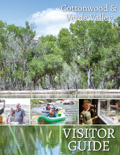
Visit Cottonwood Central Arizona
Visit Cottonwood
Central ArizonaVisit Cottonwood- Heart of Arizona Wine Country. Experience the Verde Valley Wine Trail, outdoor adventure, family fun, charming Old Town, and so much more. Request this Free Visitor GuideRequested!You're all set! Request a few more Visitor Guides, or complete the form below to receive your guides by mail.
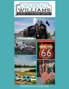
Experience Williams- Gateway to the Grand Canyon Northern Arizona
Experience Williams- Gateway to the Grand Canyon
Northern ArizonaA small town nestled in the pine country of Arizona, Williams offers countless things to see and do. Start planning your Route 66 adventure today at experiencewilliams.com! Request this Free Visitor GuideRequested!You're all set! Request a few more Visitor Guides, or complete the form below to receive your guides by mail.
Town of Clarkdale North-Central Arizona
Town of Clarkdale
North-Central ArizonaFrom the river to the rails, Clarkdale is teeming with awe-inspiring landscapes and cultural attractions that will make your visit unforgettable. Nestled in the stunning Verde Valley of North-Central Arizona. Clarkdale is the gem of Arizona. Skip the crowds and get right to the heart of red rock country. Request this Free Visitor GuideRequested!You're all set! Request a few more Visitor Guides, or complete the form below to receive your guides by mail.
Glendale Phoenix Area - Central Arizona
Glendale
Phoenix Area - Central ArizonaFrom exciting sports frenzy to signature festivals filled with family fun, unique culinary flavors, holiday splendor and more—when it comes to lifestyle, Glendale’s got you covered. Home to the nation’s finest multi-sport entertainment complex with famous shopping districts and a treasured historic downtown, Glendale is a beautiful blend of new excitement and historic charm. Request this Free Visitor GuideRequested!You're all set! Request a few more Visitor Guides, or complete the form below to receive your guides by mail.
Arizona State Parks State of Arizona
Arizona State Parks
State of ArizonaWhen it comes to epic beauty and dramatic diversity, no state compares to Arizona. Our trails are your key to unlocking a treasure chest of scenic wonders. Request this Free Visitor GuideRequested!You're all set! Request a few more Visitor Guides, or complete the form below to receive your guides by mail.
Southern ArizonaVictorian neighborhoods, locally-owned restaurants and coffee shops, bookstores, galleries and more make Bisbee a good choice for those seeking sophistication along with small town charm. Request this Free Visitor GuideRequested!You're all set! Request a few more Visitor Guides, or complete the form below to receive your guides by mail.
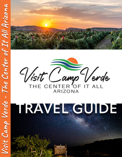
Visit Camp Verde Central Arizona
Visit Camp Verde
Central ArizonaWelcome to Camp Verde - Arizona's geological center! That's how we became known as, "The Center of It All!"
Enjoy exploring our State Parks - Fort Verde and Rockin' River Ranch. You can check out some other amazing views of the area along several hiking trails, too! Request this Free Visitor GuideRequested!You're all set! Request a few more Visitor Guides, or complete the form below to receive your guides by mail.
Bryce Canyon Country Southern Utah
Bryce Canyon Country
Southern UtahBryce Canyon Country is home to several scenically diverse state/national parks. Visitors will want to spend at least a few days exploring this spectacular part of Utah. Request this Free Visitor GuideRequested!You're all set! Request a few more Visitor Guides, or complete the form below to receive your guides by mail.
Discover Marana Tucson Arizona
Discover Marana
Tucson ArizonaDiscover the heart of the Sonoran Desert in Marana, Arizona - a destination where ancient cultures and breathtaking landscapes meet modern luxury and boundless adventure. Request this Free Visitor GuideRequested!You're all set! Request a few more Visitor Guides, or complete the form below to receive your guides by mail.
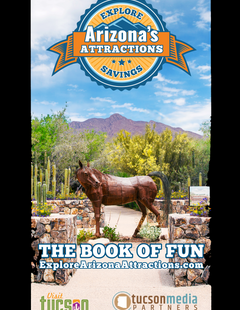
Tucson & Arizona Attractions Tucson Area, Arizona
Tucson & Arizona Attractions
Tucson Area, ArizonaThe Arizona Attractions Savings Passport is a discount savings digital pass that offers 2-for-1 admissions and special deals at more than 100 attractions across Tucson, Southern Arizona, and central and northern Arizona, providing over $600 in savings for visitors and locals alike. There are 3 versions of the Attractions Passport to choose from at varying prices, which include a 3-day Pass; a 7-Day Pass and an Annual Saving Attractions Pass valid for 365 days for the first attractions visit. Request this Free Visitor GuideRequested!You're all set! Request a few more Visitor Guides, or complete the form below to receive your guides by mail.
Benson Southeast
Benson
SoutheastBenson has a rich history tied to the railroad and Old West. A great draw for many visitors is Kartchner Caverns State Park which offers camping, hiking, beauty and of course, the caverns themselves. Request this Free Visitor GuideRequested!You're all set! Request a few more Visitor Guides, or complete the form below to receive your guides by mail.
Specialty Guides
Maverick Helicopters Nevada, Arizona, Hawaii, and California
Maverick Helicopters
Nevada, Arizona, Hawaii, and CaliforniaUnforgettable Tours Offered in Nevada, Arizona, Hawaii, and California. Request this Free Visitor GuideRequested!You're all set! Request a few more Visitor Guides, or complete the form below to receive your guides by mail.
We also have visitor guides available in states highlighted in blue below. Click on any state to see what's available.
Alaska
Arizona
California
Canada
Colorado
Hawaii
Idaho
Michigan
Montana
Nevada
New Mexico
Ohio
Oregon
Texas
Utah
Washington
Wyoming
Switch to Mobile Browser Mode
We offer a compact version of Go-Arizona for mobile users, allowing you to access just the information you need on the road. Of course, you can still use the full version of Go-Arizona on your mobile device just as you can on your desktop.